基于3D LiDAR的矿山无人驾驶车行驶边界检测
Boundary detection of mine drivable area based on 3D LiDAR
-
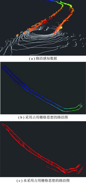
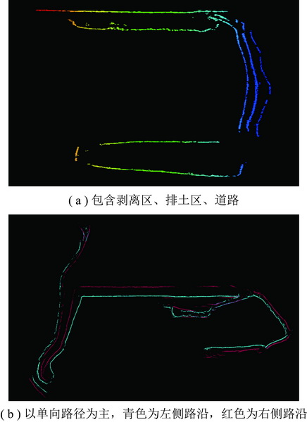
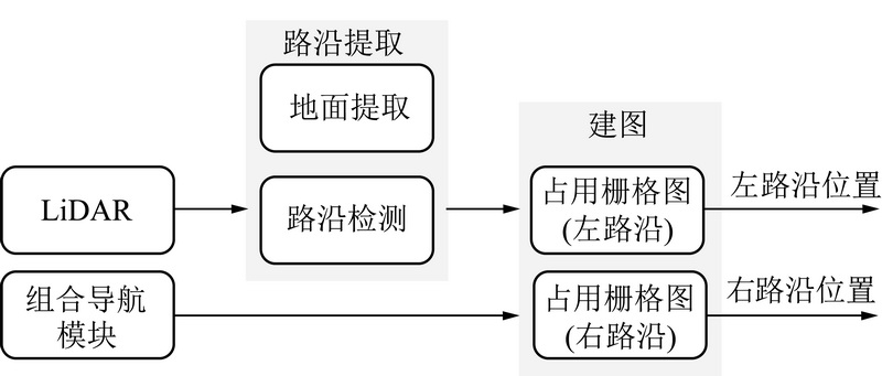
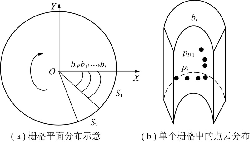
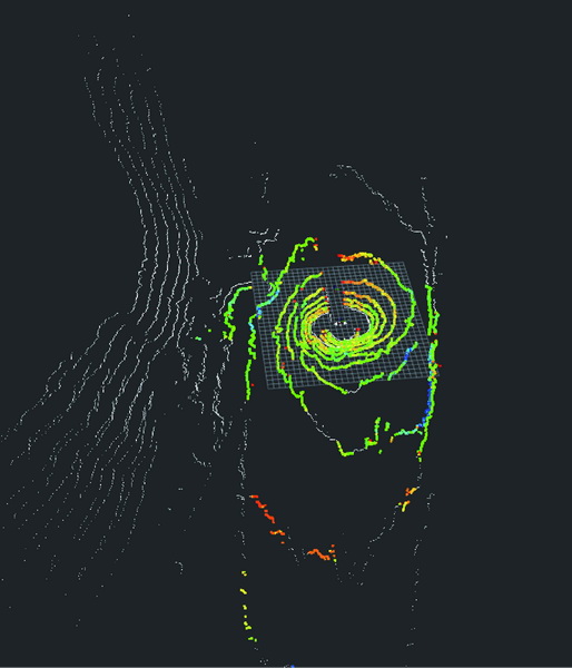
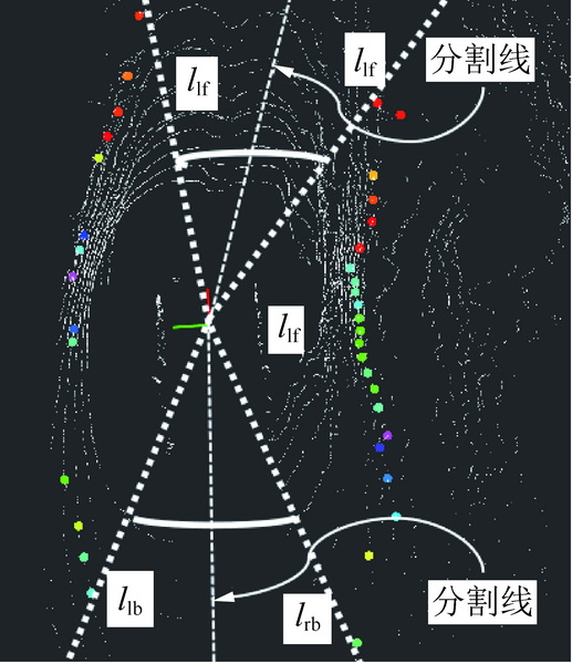
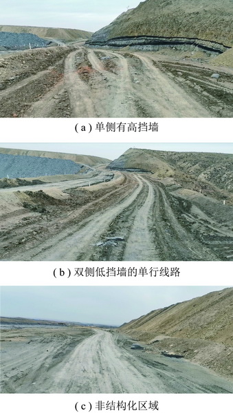
摘要: 路沿检测是矿区无人驾驶的关键技术之一,所得路沿信息可用于辅助无人矿车的感知、规划和定位。 准确的路沿检测与路沿图构建同时也是高精地图构建中的首要步骤,通过机器学的方法可以在现有路沿点的基础上初步构建道路结构拓扑。 与传统的卡尔曼框架下的路沿跟踪所不同的是,本文提出了基于占用栅格思想的路沿跟踪方案。 所谓占用栅格,即根据传感器感知到的障碍物信息来对全局范围内的场景进行构建的一种方法。 由于矿区环境下的路沿具有高度不确定性,所以需要用一种由包含概率信息的模型找出最高可能性是路沿的位置,而基于八叉树的结构正好可以满足这一需求。 本文通过将每一帧点云实时栅格化来筛选路面候选栅格,然后以环压缩为主进行多特征的路沿检测,其中栅格是一种应用已经非常广泛的点云结构,根据矿山道路本身具有的粗粒度特性,将特征检测扩展到以每一个扇形单元格为不可分割的基本单元,在提高了检测效率的同时,也避免了很多路面凹凸所带来的干扰。 路沿的跟踪策略采用基于八叉树的三维占用栅格,融合多帧检测结果,建立全局路沿地图,将传统的二维的占用栅格图的概念扩展到了三维的仅包含路沿属性的全局障碍物图。 实际矿区道路检测结果表明,本文提出的针对矿山非结构化道路的路沿检测算法可以准确地实现对矿山道路边界的检测,并可以满足无人矿车驾驶的实时性。Abstract: Road boundary detection is one of the key technologies for unmanned driving in mining areas. The obtained road boundary information can be used to assist the perception,planning and positioning of unmanned mining vehicles. Accurate road boundary detection and road boundary map construction are also the first step in the construction of high-precision maps. The road structure topology can be preliminarily constructed on the basis of existing road bounda- ry points through machine learning methods. Different from the traditional Kalman frame of road boundary tracking,this paper proposes a road boundary tracking scheme based on the idea of occupied grid. The so-called occupancy grid re- fers to a method for constructing scenes in the global scope based on obstacle information sensed by sensors. Due to the high uncertainty of road boundarys in mining areas,a model containing probability information is needed to find the lo- cation of the road boundary. The structure based on the octree can meet this demand. This paper screens the candidate road grids by rasterizing each frame of the real-time point cloud,and then performs a multi-feature road boundary de- tection based on ring compression. Among them,the grid is a point cloud structure that has been widely used. The coarse-grained nature of the mine road itself extends the feature detection to each fan-shaped cell as an inseparable basic unit,which improves the detection efficiency and avoids the interference caused by many road bumps. The road boundary tracking strategy uses a three-dimensional occupancy grid based on an octree,merges the multi-frame detec- tion results,and establishes a global road boundary map,extending the concept of the traditional two-dimensional occu- pancy grid map to a three-dimensional road boundary attribute global obstacle map. The actual mine road detection re- sults show that the proposed road edge detection algorithm for mine unstructured roads can accurately detect the mine road boundaries and can meet the requirements on the real-time driving of unmanned mine vehicles.
-
Keywords:
- mine /
- 3D LiDAR /
- curb detection /
- mapping
-
-
期刊类型引用(8)
1. 司垒,王忠宾,魏东,顾进恒,闫海峰,谭超,朱远胜. 基于IMU-LiDAR紧耦合的煤矿防冲钻孔机器人定位导航方法. 煤炭学报. 2024(04): 2179-2194 .  本站查看
本站查看
2. 王维强,孟世华,严运兵. 基于激光点云的矿用无人运输车路径规划研究. 矿山机械. 2024(10): 10-15 .  百度学术
百度学术
3. 于淼,张晞,龚子任,黄丽莎,蒙俊舟,李华志,王章宇. 基于LiDAR的煤矿井下自动驾驶边界检测与跟踪方法研究. 煤炭工程. 2023(06): 145-151 .  百度学术
百度学术
4. 薛其威,伍锡如. 基于多模态特征融合的无人驾驶系统车辆检测. 广西师范大学学报(自然科学版). 2022(02): 37-48 .  百度学术
百度学术
5. 杨春雨,张鑫. 煤矿机器人环境感知与路径规划关键技术. 煤炭学报. 2022(07): 2844-2872 .  本站查看
本站查看
6. 戴林,温江洪,齐玉龙. 基于半连续工艺与无人驾驶联动的露天煤矿运输系统. 工矿自动化. 2022(S1): 76-79 .  百度学术
百度学术
7. 詹骄,郭迟,雷婷婷,屈宜琪,吴杭彬,刘经南. 自动驾驶地图的数据标准比较研究. 中国图象图形学报. 2021(01): 36-48 .  百度学术
百度学术
8. 阎跃观,陈中章,孙阳,李泽政,姚承志. 密集低矮植被区LiDAR点云地面滤波算法. 测绘通报. 2021(07): 1-5 .  百度学术
百度学术
其他类型引用(8)


 下载:
下载:
